The story of
Ravenser Odd
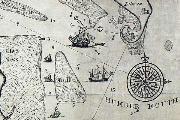
Ravenser Odd was a short-lived island in the mouth of the River Humber. It rose from the sea in the early 13th century and had sunk beneath the waves by 1360.
Piece
Catalogue reference: ZMAP 5/7
This record is about the 'Burdett's Map of Derbyshire 1791', reproduced in 18 sheets with an introduction... dating from 1791;1975 in the series Facsimile Reproductions of Miscellaneous Maps and Charts. It is held at The National Archives, Kew.
Sorry, information for accessing this record is currently unavailable online. Please try again later.
'Burdett's Map of Derbyshire 1791', reproduced in 18 sheets with an introduction by J B Harley, D V Fowkes & J C Harvey. Derbyshire Archaelogical society, 1975
ZMAP 5
See the series level description for more information about this record.
'Burdett's Map of Derbyshire 1791', reproduced in 18 sheets with an introduction...
Read stories that share a catalogue subject with this record.
The story of
Records that share similar topics with this record.