Focus on
Henry Savage Sweetman: The man who uncovered Ireland’s medieval history

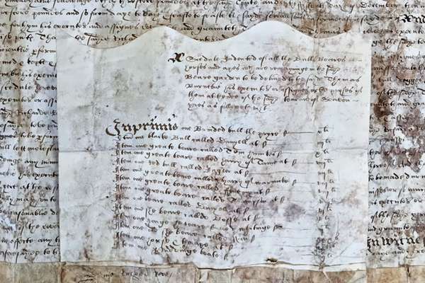
Henry Savage Sweetman published the Calendar which translated over 8,000 Irish medieval records. But who was Sweetman and why did he complete this project?
Piece
Catalogue reference: MPI 1/677
This record is about the Extracted from OS 23/585. Derbyshire. Map of part of the parish of Matlock traced... dating from 1892 in the series Public Record Office: Maps and plans extracted to flat storage from various series.... It is held at The National Archives, Kew.
No, this record is not available online. However, you can order a copy. Other ways to view it.
Yes, this record is held at The National Archives and is available to see in person. How to view it.
Extracted from OS 23/585. Derbyshire. Map of part of the parish of Matlock traced from tithe plan of 1850 annotated to show boundaries between Matlock Bath and Scarthin Nick. Scale: 1 inch to 66 yards. Compass indicator. Initialled 'J.L.A. 1.3.92'; [1892]. Originally filed with correspondence between Ordnance Survey at Wirksworth and estate agents and overseers at Matlock and Cromford on correct parish boundary between Matlock and Matlock Bath, April-May 1920; other sketch plans remain in the file.
MPI 1
See the series level description for more information about this record.
Extracted from OS 23/585. Derbyshire. Map of part of the parish of Matlock traced...
Read stories that share a catalogue subject with this record.
Focus on
Record revealed

Record revealed
Records that share similar topics with this record.