Record revealed
Adrienne de Lafayette’s letter to her husband, Marquis de Lafayette
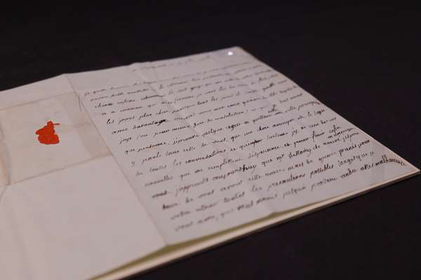
This previously unknown letter from Adrienne de Lafayette reveals her unfailing love for her husband.
Piece
Catalogue reference: MPG 1/690
This record is about the 1 item extracted from CO 42/166 (folio 177). Quebec. 'Plan of that part of the Frontier... dating from 1816 in the series Public Record Office: Maps and plans extracted to flat storage from various series.... It is held at The National Archives, Kew.
Sorry, information for accessing this record is currently unavailable online. Please try again later.
1 item extracted from CO 42/166 (folio 177). Quebec. 'Plan of that part of the Frontier of Lower Canada... between Montreal & Lake Champlain, with the Rivers, Roads, Settlements, Forts, Islands, Woods and Swamps...Seigniories and Townships...Surveyor General's Office, Quebec the 13th April 1816'. Scale: 1 inch to 2 miles. Reference table of symbols used. Compass indicator. By William Sax, Acting Surveyor General.
MPG 1
See the series level description for more information about this record.
1 item extracted from CO 42/166 (folio 177). Quebec. 'Plan of that part of the Frontier...
Read stories that share a catalogue subject with this record.
Record revealed
Focus on

The story of
Records that share similar topics with this record.