Record revealed
Adrienne de Lafayette’s letter to her husband, Marquis de Lafayette
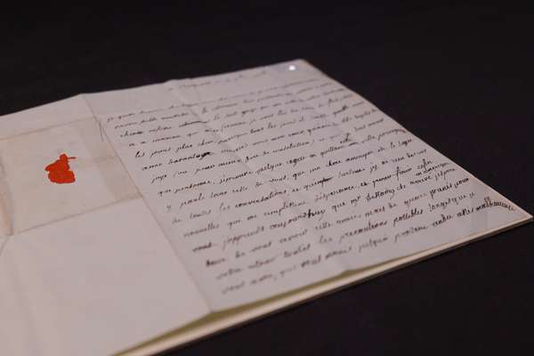
This previously unknown letter from Adrienne de Lafayette reveals her unfailing love for her husband.
Piece
Catalogue reference: MPG 1/280
This record is about the 1 item extracted from CO 5/69 (f 173). North America. Map showing boundary lines... dating from 1768 in the series Public Record Office: Maps and plans extracted to flat storage from various series.... It is held at The National Archives, Kew.
Sorry, information for accessing this record is currently unavailable online. Please try again later.
1 item extracted from CO 5/69 (f 173). North America. Map showing boundary lines between the British colonies and the country of the Six Nations and the Southern Indians, as recommended in the Representation of 7 March 1768 from the Lords Commissioners for Trade and Plantations to the King. Scale: 1 inch to about 87 miles. Appendix B to a 'Plan for Settlement of Indian Affairs'.
MPG 1
See the series level description for more information about this record.
1 item extracted from CO 5/69 (f 173). North America. Map showing boundary lines...
Read stories that share a catalogue subject with this record.
Record revealed
Focus on

The story of
Records that share similar topics with this record.