Record revealed
Adrienne de Lafayette’s letter to her husband, Marquis de Lafayette
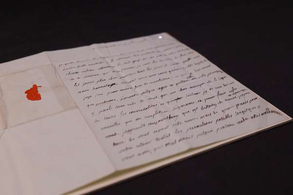
This previously unknown letter from Adrienne de Lafayette reveals her unfailing love for her husband.
Piece
Catalogue reference: MPK 1/305
This record is about the 1 item extracted from FO 5/2415 (folio 347). Canada. 'Yukon Map': sheet 5 only of... dating from 1898-1899 in the series Public Record Office: Maps and plans extracted to flat storage from various series.... It is held at The National Archives, Kew.
Sorry, information for accessing this record is currently unavailable online. Please try again later.
1 item extracted from FO 5/2415 (folio 347). Canada. 'Yukon Map': sheet 5 only of a 10-sheet topographical map, showing the boundary between British Columbia and the Yukon District (now Yukon Territory). Reference notes of mountain heights, geology, vegetation, speed of river currents. Scale: 1 inch to 6 miles. Prepared in the Surveyor-General's Office, Department of the Interior, Ottawa, March-June 1898. MS additions at the northern end of the Lynn Canal show the Canadian and United States proposals for the boundary between Alaska and British Columbia.
MPK 1
See the series level description for more information about this record.
1 item extracted from FO 5/2415 (folio 347). Canada. 'Yukon Map': sheet 5 only of...
Read stories that share a catalogue subject with this record.
Record revealed
Focus on

The story of
Records that share similar topics with this record.