The story of
Ravenser Odd
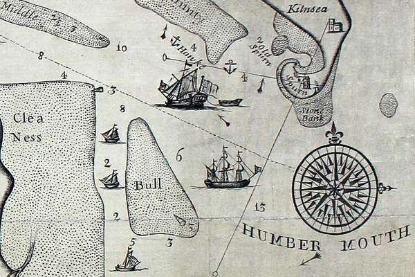
Ravenser Odd was a short-lived island in the mouth of the River Humber. It rose from the sea in the early 13th century and had sunk beneath the waves by 1360.
Piece
Catalogue reference: OS 23/711
This record is about the Parish name book: Ramsgate, Kent. National Grid Reference: TR 3865. (Related OS six-inch... dating from 1867-1939 in the series Ordnance Survey: Boundaries Branch: Parish Name Books. It is held at The National Archives, Kew.
Sorry, information for accessing this record is currently unavailable online. Please try again later.
Parish name book: Ramsgate, Kent. National Grid Reference: TR 3865. (Related OS six-inch County series sheet(s): Kent XXV, XXVI, XXXVII, XXXVIII)
OS 23
See the series level description for more information about this record.
Parish name book: Ramsgate, Kent. National Grid Reference: TR 3865. (Related OS six-inch...
Read stories that share a catalogue subject with this record.
The story of
Records that share similar topics with this record.