Record revealed
Adrienne de Lafayette’s letter to her husband, Marquis de Lafayette
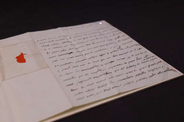
This previously unknown letter from Adrienne de Lafayette reveals her unfailing love for her husband.
Piece
Catalogue reference: CO 700/NewYork32
This record is about the Copy of a Map of part of New York and New Hampshire, distinguishing Townships formerly... dating from 1766 in the series Colonial Office and predecessors: Maps and Plans: Series I. It is held at The National Archives, Kew.
Sorry, information for accessing this record is currently unavailable online. Please try again later.
Copy of a Map of part of New York and New Hampshire, distinguishing Townships formerly granted by the Government of New Hampshire, and lands already granted by this Government lying westward of Connecticut River, northward of the north Line of Massachusets Bay Government, and Eastward of Hudson's River, Lake George and Lake Champlain. By Alex. Colden, Surveyor General, New York, 22 January 1766. MS. 1 inch to 6 miles
For the manuscript original of this map see MPQ 1/1
CO 700
See the series level description for more information about this record.
Copy of a Map of part of New York and New Hampshire, distinguishing Townships formerly...
Read stories that share a catalogue subject with this record.
Record revealed
Focus on

The story of
Records that share similar topics with this record.