Record revealed
Adrienne de Lafayette’s letter to her husband, Marquis de Lafayette
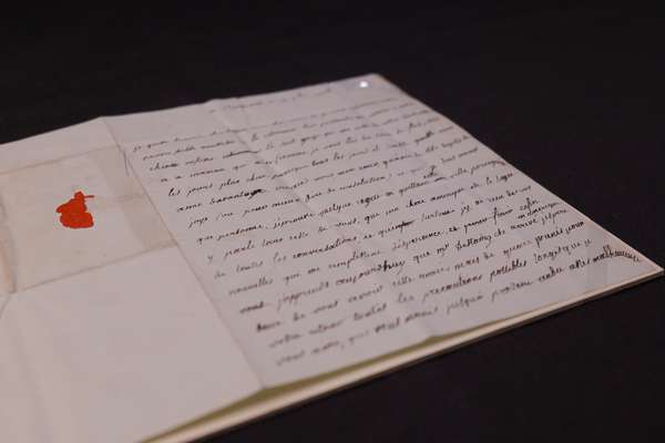
This previously unknown letter from Adrienne de Lafayette reveals her unfailing love for her husband.
Piece
Catalogue reference: CO 700/AmericaNorthandSouth21
This record is about the A map of the British and French Dominions in North America, with the roads, distances,... dating from 1755 in the series Colonial Office and predecessors: Maps and Plans: Series I. It is held at The National Archives, Kew.
No, this record is not available online. Other ways to view it.
Yes, this record is held at The National Archives and is available to see in person. How to view it.
A map of the British and French Dominions in North America, with the roads, distances, limits and extent of the Settlements. By. Jno. Mitchell. Tho. Kitchin, Sculp. Published by the author, 13 February 1755. and sold by And. Millar. in the Strand. 30 miles to 1 inch.
CO 700
See the series level description for more information about this record.
A map of the British and French Dominions in North America, with the roads, distances,...
Read stories that share a catalogue subject with this record.
Record revealed
Focus on

The story of
Records that share similar topics with this record.