The story of
Ravenser Odd
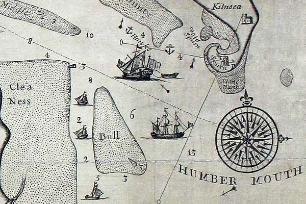
Ravenser Odd was a short-lived island in the mouth of the River Humber. It rose from the sea in the early 13th century and had sunk beneath the waves by 1360.
Piece
Catalogue reference: IR 30/19/34
This record is about the Altered apportionment map of Church Langton (parish), Leicestershire; corn-rent conversion... dating from 1936 in the series Tithe Commission and Successors: Tithe Maps. It is held at The National Archives, Kew.
Sorry, information for accessing this record is currently unavailable online. Please try again later.
Altered apportionment map of Church Langton (parish), Leicestershire; corn-rent conversion following enclosure award. There is no original tithe map for this tithe district. The map at this reference is an altered apportionment map for the townships or hamlets of West Langton, East Langton, Thorpe Langton and Tar Langton, based on an Ordnance Survey 1:2,500 map. Shows only area centred on Tur Langton village, church and manor house
Tithe file: IR 18/4417
Tithe apportionment:
IR 30
See the series level description for more information about this record.
Altered apportionment map of Church Langton (parish), Leicestershire; corn-rent conversion...
Read stories that share a catalogue subject with this record.
The story of
Records that share similar topics with this record.