The story of
Ravenser Odd
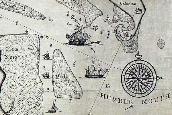
Ravenser Odd was a short-lived island in the mouth of the River Humber. It rose from the sea in the early 13th century and had sunk beneath the waves by 1360.
Piece
Catalogue reference: IR 30/18/168
This record is about the Tithe map of Hoole [Much Hoole] (parish), Lancashire. Shows buildings (named), modus... dating from 1839 in the series Tithe Commission and Successors: Tithe Maps. It is held at The National Archives, Kew.
Sorry, information for accessing this record is currently unavailable online. Please try again later.
Tithe map of Hoole [Much Hoole] (parish), Lancashire. Shows buildings (named), modus land, woods, heath/moor, pinfold, footpath and/or bridleway, waterbodies, changes in river course. Colouring used. Decorative border and compass indicator. Scale: 1 inch to 3 chains. Map of Much Hoole 'enlarged and copied' by John J Myres and Miller and Hunter from John Clifton's survey; map of Little Hoole 'copied from a survey made in the year 1774 showing the alterations and additions' by Myres
Tithe file: IR 18/4101
Tithe apportionment:
IR 30
See the series level description for more information about this record.
Tithe map of Hoole [Much Hoole] (parish), Lancashire. Shows buildings (named), modus...
Read stories that share a catalogue subject with this record.
The story of
Records that share similar topics with this record.