Record revealed
The first American invention to obtain an English patent
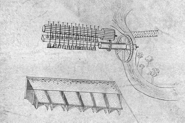
These intricate 1716 drawings were submitted by Sybilla Masters in the final stage of securing a patent for machinery for 'cleaning and curing Indian corn'.
Piece
Catalogue reference: IR 30/13/118
This record is about the Tithe map of King Stanley [King's Stanley] (parish), Gloucestershire. Shows orchards,... dating from 1838 in the series Tithe Commission and Successors: Tithe Maps. It is held at The National Archives, Kew.
Sorry, information for accessing this record is currently unavailable online. Please try again later.
Tithe map of King Stanley [King's Stanley] (parish), Gloucestershire. Shows orchards, parkland, plantations and woods (both coloured), named open fields, landownership, arable, grassland, fences, quarry, named hills, hill-drawing, waterbodies. Scale: 1 inch to 6 chains.
With 1 altered apportionment map
Tithe file: IR 18/2773
Tithe apportionment:
IR 30
See the series level description for more information about this record.
Tithe map of King Stanley [King's Stanley] (parish), Gloucestershire. Shows orchards,...
Read stories that share a catalogue subject with this record.
Record revealed
Focus on
The story of
Records that share similar topics with this record.