The story of
Ravenser Odd
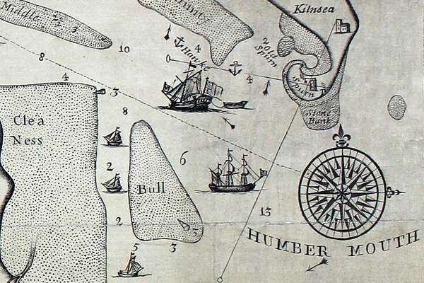
Ravenser Odd was a short-lived island in the mouth of the River Humber. It rose from the sea in the early 13th century and had sunk beneath the waves by 1360.
Piece
Catalogue reference: IR 30/5/237
This record is about the Tithe map of High Leigh (township in the parish of Rostherne), Cheshire. Shows buildings... dating from 1848 in the series Tithe Commission and Successors: Tithe Maps. It is held at The National Archives, Kew.
Sorry, information for accessing this record is currently unavailable online. Please try again later.
Tithe map of High Leigh (township in the parish of Rostherne), Cheshire. Shows buildings (named), named roads, footpath and/or bridleway, parkland, plantations, woods,waterbodies. Colouring used. Scale: 1 inch to 8 chains. By Henry White, Warrington. Note on map: 'This plan is compiled from the old Estate plans of the Landowners with corrections up to the present time. Where no alterations had been made in the fences the old quantities were for the most part adopted'
Tithe file: IR 18/109
Tithe apportionment:
IR 30
See the series level description for more information about this record.
Tithe map of High Leigh (township in the parish of Rostherne), Cheshire. Shows buildings...
Read stories that share a catalogue subject with this record.
The story of
Records that share similar topics with this record.