Record revealed
Request for compensation for the Boston Tea Party
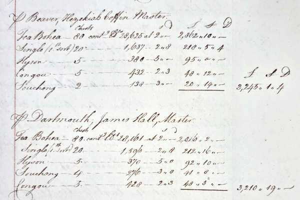
On 16 December 1773, 340 chests of tea were thrown into Boston harbour by protesting colonists. This letter from the East India Company requests reimbursement.
Series
Catalogue reference: IR 93
IR 93
These maps were used by the Tithe Redemption Office to record the boundaries of parishes, particularly those for which no tithe map had been made or in which only the lands liable to tithe rentcharge were mapped.
These maps were used by the Tithe Redemption Office to record the boundaries of parishes, particularly those for which no tithe map had been made or in which only the lands liable to tithe rentcharge were mapped.
Board of Inland Revenue: Tithe Redemption Office: Ordnance Survey Maps (Six-Inch Maps)
Read stories that share a catalogue subject with this record.
Record revealed
Focus on

Record revealed
Records that share similar topics with this record.