Focus on
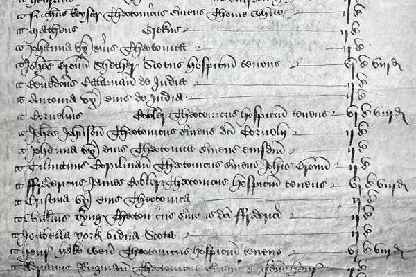
Henry Savage Sweetman: the man who uncovered Ireland’s medieval history

Henry Savage Sweetman published the Calendar which translated over 8,000 Irish medieval records. But who was Sweetman and why did he complete this project?
Series
Catalogue reference: BD 48
BD 48
This series contains a set of maps produced for the Planning Services Division of the Welsh Office using information derived from the 1971 Census returns, as a way of graphically analysing data from the returns. Their purpose was to illustrate...
BD 48
1971-1974
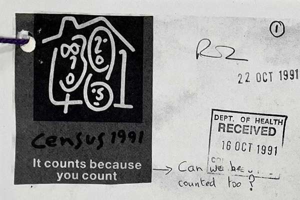
This series contains a set of maps produced for the Planning Services Division of the Welsh Office using information derived from the 1971 Census returns, as a way of graphically analysing data from the returns. Their purpose was to illustrate the socio-economic distribution of population (based on the socio-economic position of the head of the household) so that areas of greatest need could be identified as part of the general planning process being carried out by the Welsh Office at that time.
Public Record(s)
English
38 flat sheet(s)
Subject to 30 year closure
Records created or inherited by the Welsh Office and the Wales Office
Welsh Office: Planning Services Division: 1971 Census Data Maps
Focus on
Record revealed
Focus on
Records that share similar topics with this record.