The story of
Thomas Cromwell
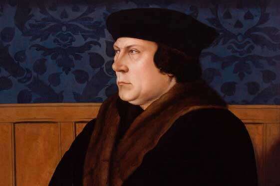
Through intrigue and ambition Thomas Cromwell rose to become one of Henry VIII's key advisors. What can records at The National Archives tell us about his life?
Piece
Catalogue reference: WORK 31/21
This record is about the Tower of London: General. Plan shows the Tower and its gates and bulwark; wharf,... dating from [1670s] in the series Office of Works and successors: Ancient Monuments and Historic Buildings: Plans and.... It is held at The National Archives, Kew.
No, this record is not available online. However, you can order a copy. Other ways to view it.
Yes, this record is held at The National Archives and is available to see in person. How to view it.
WORK 31/21
[1670s]
Tower of London: General. Plan shows the Tower and its gates and bulwark; wharf, rivergate [Traitor's Gate] and stairs; streets, houses and Barking church to the west; Tower Hill, 'Crochet Friars' [Crutched Friars]. and East Smithfield to the north; St Katherine's to the east. Scale bar: 1 inch to about 70 feet. Damaged at edges.Annotated: 'A coppy of Mr Hewards Mapp verified by Jonas Moore'. This refers to William Hayward and Joel Gascoyne's map of 1597, known from later engraving. Sir Jonas Moore was Surveyor of the Ordnance and resident at the Tower in the 1670s; he signed and verified this copy map.
AC/TOL:GEN/6; Reg No E/6/1606; T S 207
Public Record(s)
54.5 cm x 73.5 cm
Ink drawing on Michalette type paper, coloured. Mounted on canvas.
Open Document, Open Description
WORK 31
See the series level description for more information about this record.
Records of the successive Works departments, and the Ancient Monuments Boards and...
Office of Works and successors: Ancient Monuments and Historic Buildings: Plans and...
Tower of London: General. Plan shows the Tower and its gates and bulwark; wharf,...
The story of
The story of

Record revealed
Records that share similar topics with this record.