Focus on
The Huey Fong: Hong Kong's 1979 refugee crisis
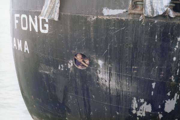
In December 1978, Vietnamese refugees seeking asylum aboard the Huey Fong were refused entry to Hong Kong. Records we hold document the 34-day standoff.
Piece
Catalogue reference: OD 6/856
This record is about the Geological mapping: New Hebrides dating from 1960-1969 in the series Directorate of Overseas Surveys: Registered Files. It is held at The National Archives, Kew.
No, this record is not available online. However, you can order a copy. Other ways to view it.
Yes, this record is held at The National Archives and is available to see in person. How to view it.
OD 6/856
1960-1969
Geological mapping: New Hebrides
With maps
508/5GEOL
Public Record(s)
Open Document, Open Description
OD 6
See the series level description for more information about this record.
Records created or inherited by the Department of Technical Co-operation, and successive...
Directorate of Overseas Surveys: Registered Files
Geological mapping: New Hebrides
Focus on
The story of

The story of

Records that share similar topics with this record.