Record revealed
Request for compensation for the Boston Tea Party
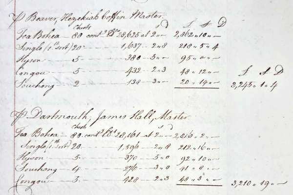
On 16 December 1773, 340 chests of tea were thrown into Boston harbour by protesting colonists. This letter from the East India Company requests reimbursement.
Series
Catalogue reference: OS 90
OS 90
This series contains dated gathered versions (or 'snapshots') of the Election Maps website. [Please note: These records may be accessed via the UK Government Web Archive].
This series contains dated gathered versions (or 'snapshots') of the Election Maps website. [Please note: These records may be accessed via the UK Government Web Archive].
Please see information at Divisional level.
The Elections Maps website is designed to help the understanding of the electoral geography of Great Britain and Northern Ireland. It is for use to see the extent of electoral constituencies against various scales of mapping background.
Records of the Ordnance Survey of Great Britain
Election Maps Website
Record revealed
Record revealed
The story of

Records that share similar topics with this record.